Portage Lakes--North Reservoir
Portage Lakes--North Reservoir
Akron, Ohio 44319
Portage Lakes mapPortage Lakes State Park website
Portage Lakes State Park map
Tips for Birding
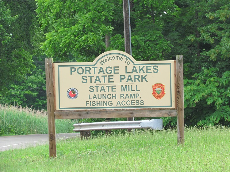
Use this hotspot to report birds seen on the North Reservoir from State Mill Road or Portage Lakes Drive. Use the Myers Island hotspot to report birds seen on or from Myers Island.
There are two points of access and parking for the North Reservoir, one is the boat ramp on State Mill Road and the other is on Portage Lakes Drive. Myers Island is a separate hotspot.
State Mill Highlights: Colony of Purple Martin gourds, nesting Osprey, migrating and wintering waterfowl such as Common Loon, all three merganser species, and Common Goldeneye
Birds of Interest
Caspian and Forster’s Tern, Common Loon
About Portage Lakes
See all hotspots at Portage Lakes
The Portage Lakes are a group of reservoirs in Northeast Ohio. The name comes from an old Indian portage path that connected the Cuyahoga River flowing north to Lake Erie and the Tuscarawas River, a tributary of the Muskingum River, that flows south to the Ohio River. This proved advantageous for the Indians and early settlers as navigation from Lake Erie to the Ohio River was possible with only an 8 miles portage overland. Portage Lakes State Park lies at one of the highest points of the state and on a major watershed divide in Ohio. Some water from the lakes reaches Lake Erie and some flows to the Ohio River.
In 1825 the Ohio Legislature appropriated funds for the construction of a large network of canals and reservoirs to supply water for the canal system. The Portage Lakes, a series of lakes south of Akron, were created as part of this network of water supply reservoirs. They were formed by the construction of dikes and dams to raise the water levels of some of the swamps and small lakes typical of this heavily glaciated southern part of Summit County.
The use of the Portage Lakes as a water supply for the canal system ceased in 1913 when the canal was abandoned as a means of transportation. However, during this period the rubber industry was expanding in Akron, and the demand for industrial water increased. The Portage Lakes and a portion of the canal system were used to meet the water demands for industrial development along the canal and Summit Lake. During the dry years of the early 1930s, the Portage Lakes were drawn down to such an extent that a new reservoir, Nimisila, was built to direct water from Nimisila Creek into the Portage Lakes.
The Portage Lakes are at three topographical levels. Long Lake, the lowest lake, was formed by flooding a swamp area that had a small pothole lake at its south end. North Reservoir and the middle level were formed by a dike flooding a flat area of land and a small pothole lake known as Hower Lake. At the highest level, and impounding the largest acreage of water, 1,192 acres, are three separate reservoirs: East, West, and Turkeyfoot. Turkeyfoot Lake is connected to West Reservoir by a channel. West Reservoir overflows into North Reservoir and is connected to East Reservoir by a channel. East Reservoir has a control structure from which water is released into a channel that flows into Long Lake.
Turkeyfoot Lake: 483 surface acres – 12.6 feet average depth
West Reservoir: 105 surface acres – 11.3 feet average depth
East Reservoir: 208 surface acres – 14.8 feet average depth
North Reservoir: 165 surface acres – 10.0 feet average depth
Long Lake: 231 surface acres – 16.3 feet average depth
Restrooms are at some locations within the Portage Lakes, and there are gas stations and restaurants nearby.
Features
Restrooms on site
Wheelchair accessible trail
Entrance fee
Roadside viewing
Content from Susan Carpenter

