Berlin Lake--Greenbower Bridge

Berlin Lake--Greenbower Bridge
Greenbower Street Northeast Alliance, Ohio 44601
Official WebsiteMahoning Valley Trail map
Berlin Lake Official Website
US Army Corps of Engineers Water Management website
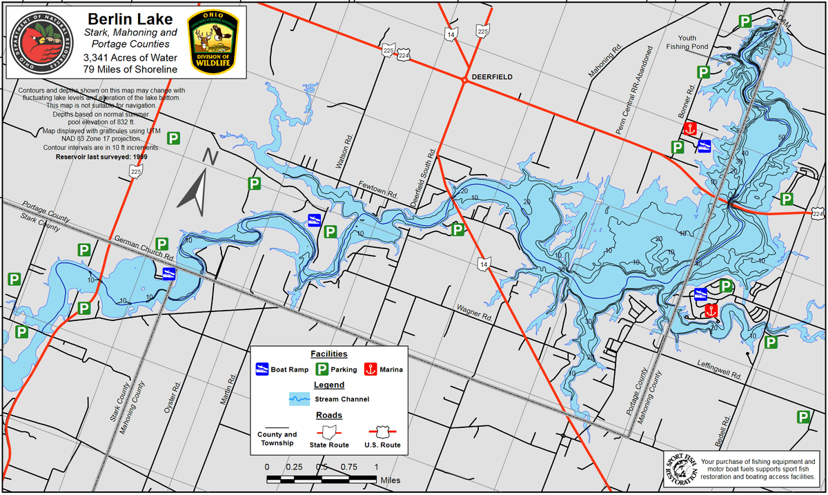
Berlin Lake map
Mahoning Valley Trail Official Website
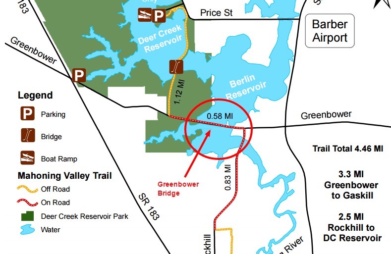
Mahoning Valley Trail map
Also, see all the hotspots at:
Berlin Lakes System Important Bird Area
Berlin Lake Birding Drive
About this Location
There is an unmarked and unpaved parking spot on the north side of the road, but it is a rather steep entry. Several vehicles can park there. It may be better to park on the other side of the street along the edge of the Stark Parks walking path. Other fishers and birders often park there. The walking path seems new there or recently upgraded with fresh surface and new signs. There is a marked crosswalk and the walking path continues east, across the bridge and a bit beyond where it then turns north, eventually heading across the dam between Deercreek and Walborn. There is also a sign marking it as a bike lane.
About Berlin Lake
See all hotspots at Berlin Lake
Berlin Lake spans three counties. The eastern portion is in Stark County, the middle portion is in Portage County, and the western portion is in Mahoning County. See the map for the county line boundaries.
Berlin Lake lies in the northeastern part of Ohio at the junction of Stark, Portage, and Mahoning counties. The lake is located on and is accessible from US-224 and OH-14 and OH-225. The U.S. Army Corps of Engineers constructed Berlin Lake in 1942 on the Mahoning River. The Congressionally authorized purposes were flood control, low flow augmentation, water quality control, and water supply. Berlin Lake has a mean depth of 23 feet with a maximum depth of 55 feet. Annual water level fluctuations can be as much as 20 feet. Mud, sand, and gravel make up most of the bottom composition. Rock ledges can be seen along the original river channel at low pool level.
Restroom facilities can be found at the headquarters building, the picnic area by the dam, and the Circle Restaurant in Deerfield.
About Mahoning Valley Trail
See all hotspots at Mahoning Valley Trail
The Mahoning Valley Trails begins at Deer Creek Reservoir (14514 Price Street Northeast, Alliance, Ohio 44641) west of OH-225 and continues to Gaskill Drive. Parking lot just north of Earley Hill Park. The route includes a 260-foot free-span bridge over Deer Creek, a 100-foot boardwalk under OH-225, and an on-road section using Greenbower Street and Rockhill Avenue. Future plans will move the trail off the road and south to the City of Alliance.
This scenic trail offers fishing access to the Mahoning River and a great view of a bottomland hardwood forest. Spring flowers are abundant along the trail and include jack in the pulpit, false Solomon’s seal, and swamp buttercup.
The Mahoning Valley Trail has been adopted by the Rotary Club of Alliance, the club sponsors cleanup projects along the trail throughout the year.
Deer Creek Reservoir to Gaskill Drive, 4.46 miles
The Stark County Park District prohibits the use of motorized vehicles in this park and on its trails. Sections of the trail may not be suitable for wheelchair access. The weather may impact the accessibility of trails, always use caution.
Content from Mahoning Valley Trail Official Website, Chris Lamb, Ohio Ornithological Society, and Susan Carpenter