Buzzards Roost Nature Preserve
Buzzards Roost Nature Preserve
514 Redbird Lane Chillicothe, Ohio 45601
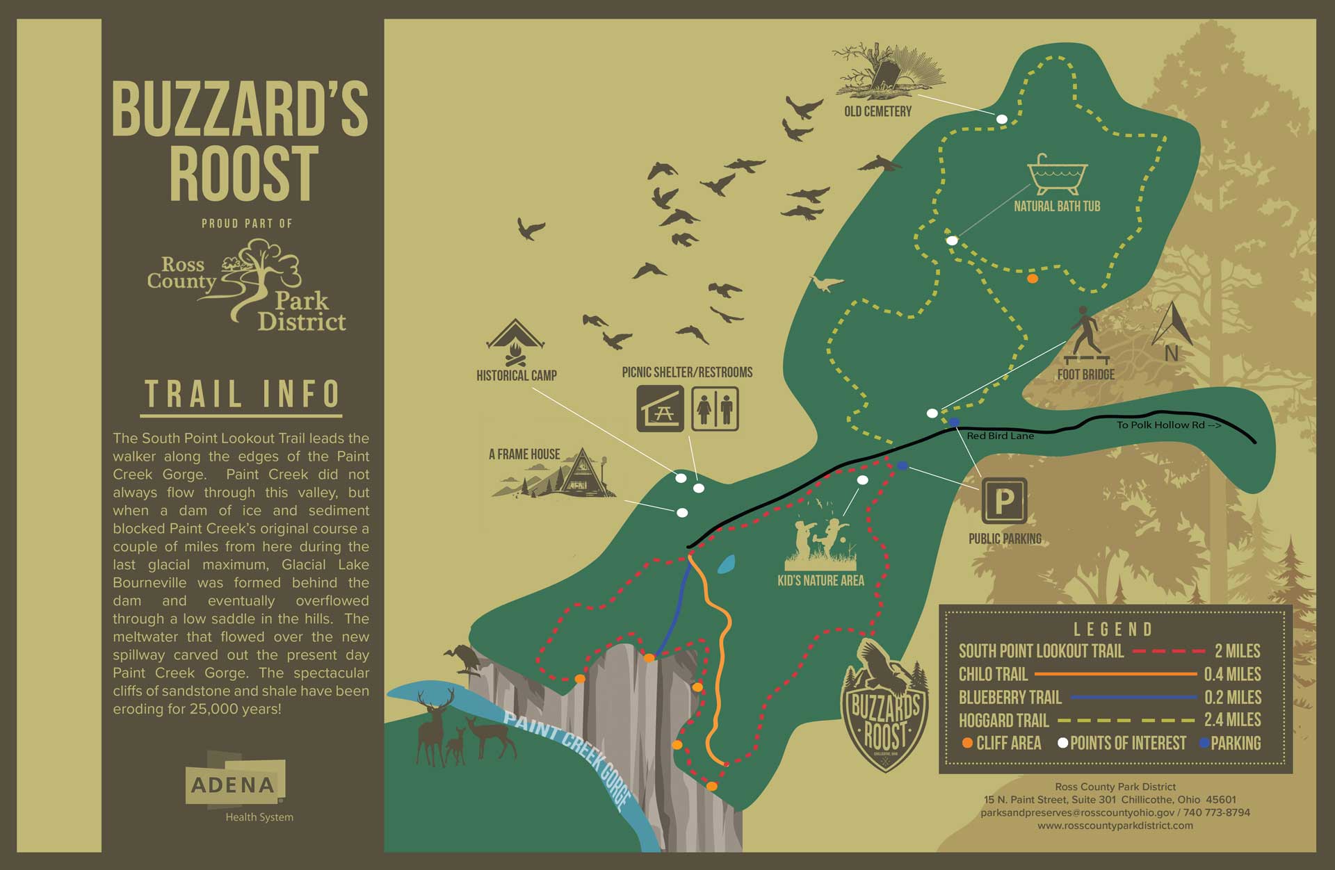
Official WebsiteBuzzards Roost Nature Preserve map
Tips for Birding
Buzzards Roost Nature Preserve includes densely wooded upland and much of the wooded Paint Creek Gorge, along with a few meadows and a small pond. This is a good location to find birds typical of unglaciated forest areas.
About this Location
The Earl H. Barnhart “Buzzard’s Roost” Nature Preserve conserves nearly 1200 acres of the most rugged and scenic country in this area.
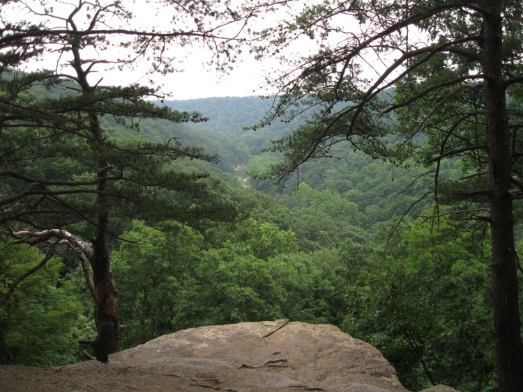
Over 6 miles of forested trail meander past ponds, vernal pools, the crumbling remains of old homesteads, and deep, wooded ravines. A walk on the South Point Lookout Trail offers magnificent views of the vertical cliffs of sandstone and shale that descend into the beautiful Paint Creek Gorge.
Notable Trails
Buzzards Roost Nature Preserve Trails
Trails at Buzzards Roost Nature Preserve include:
South Point Lookout Trail – 1.6 mile loop – blazed red
This trail leads the walker along the edges of the Paint Creek Gorge. The spectacular cliffs of sandstone and shale were once the sea floor and have been eroding for 250 centuries! Paint Creek didn’t originally flow through this valley, but when ice and sediment blocked its original course a couple of miles north of here during the last glacial maximum, Glacial Lake Bourneville was formed behind the dam, which eventually overflowed through the low saddle in the hills. The meltwater from the new spillway carved out the present day Paint Creek Gorge.
Chilo Trail – .4 mile – blazed orange
The Chilo Trail is a short trail that dead ends into the South Point Lookout Trail very near the lookout (Just turn right and you are there). There are three vernal pools along this trail – leftover farm ponds from a century ago. The trail is named after Chilo, “the prince of the mound builders” in the 1936 booklet, “Chilo Speaks.” Chilo implores the reader to preserve the natural beauty of the “Valley of the Kings,” referring to the Paint Creek Gorge.
Hoggard Trail – short loop 2.4 miles, long loop 3.7 miles – blazed red
A portion of this trail follows what was once a road that connected Redbird Lane with Hatmaker Lane in Slate Mills. The road was closed during the Great Depression of the 1930’s due to lack of use. The trail meanders through the old Hoggard Homestead (the cemetery still stands along the side of the trail), past the remnants of an old farm and two abandoned agricultural ponds (now valuable habitat for wildlife), and through a beautiful pine forest on the long loop.
Blueberry Trail – .5 mile – blazed in blue
This short segment introduces the walker to the western most cliffs (where blueberries once grew) on this side of Paint Creek. Watch for buzzards warming up in the tree tops along the cliffs in the morning sun.
Descriptions with maps of hikes on trails at the Buzzards Roost Nature Preserve are on the AllTrails website.
Features
Restrooms on site
Content from Official Website and Rob Thorn