Pleasant Hill Lake

Pleasant Hill Lake
Perrysville, Ohio 44864
Pleasant Hill Lake mapPleasant Hill Lake Region (Muskingum Watershed Conservancy District) map
Tips for Birding
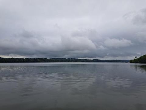
Pleasant Hill Lake is good during migration for observing waterfowl and gulls. Unusual gulls seen at the swimming beach in late summer and autumn have been California, Lesser Black-backed, Franklin’s, and Laughing. A few Caspian terns also use this area during migration.
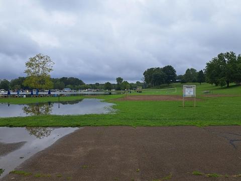
The Swimming Beach: The swimming beach is located along the north shore of the lake. Drive in the Pleasant Hill Lake State Park entrance and continue straight to the lake. There is a parking lot on a hill above the beach. Another option is to drive around the west side of the building at the end of the entrance road, continuing past boat docks until you are at the beach. The swimming beach is good early in the spring until mid-May and in late August until the lake freezes.
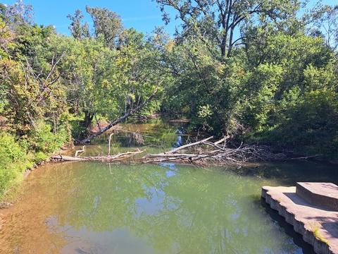
West portion of the lake: To get to this location, while driving along OH-95 east of OH-603, turn south onto Covert Road, which is one mile east of the OH-95 and OH-603 intersection. Continue on Covert Road until the road curves to the left. At this curve, there is a gravel lane to the right, which has a small green “no camping” sign at its beginning. Continue slowly on this lane until you come to its end. Park here and walk to the lake to view waterfowl, osprey, and eagles.
Another location to view the west part of the lake is on the south side of the lake. From the intersection of OH-603 and OH-95 take OH-95 southwest towards Butler. Take the first road to the left, Pleasant Hill Road. Continue on this road to the first road to the left, Barron Road. Continue along Barron Road until its end at the lake, where there is a small parking area.
The central portion of the lake: After entering the State Park continues until just before the parking lot on the hill, above the swimming beach. There is a park road that parallels the lake, in an easterly direction. There are woods along this road where migrant songbirds can be found. Park along any of the pull-offs along this park road and walk to the lake to search for waterfowl, gulls, Osprey, and Bald Eagles.
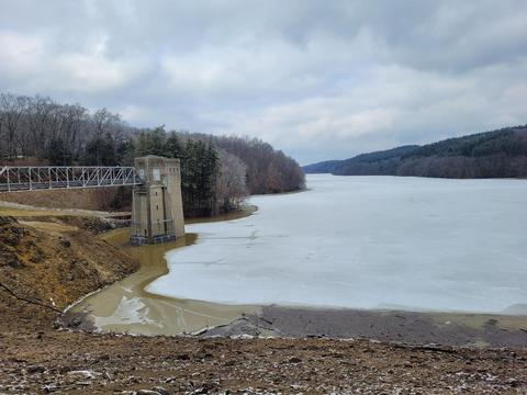
Pleasant Hill Lake Dam: From Butler take OH-97 east to McCurdy Road. Continue north on McCurdy until turning right onto Good Road, which has a sign at this intersection, to the Mohican State Park Lodge. Continue on Goon Road (do not take the drive to the lodge) as it winds around the hills until it comes out at the dam. Probably the best attribute of this location is the spectacular view of the Mohican Gorge and Pleasant Hill Lake.
The lake is 13 miles southeast of Mansfield. From the intersection of I-71 and OH-97, take OH-97 east to Butler. In Butler, take OH-95 northeast to Pleasant Hill Lake.
Open all year during daylight hours.
Birds of Interest
Winter
Bald Eagles are present until the lake freezes.
Spring
Waterfowl and Caspian terns.
Summer
Late summer – gulls. Two Osprey nesting platforms exit at Pleasant Hill Lake, in hopes of attracting nesting birds.
Fall
In late fall the water level is lowered at the lake creating mud flats in the west end. One winter a Dunlin and two Sandhill Cranes wintered at this part of the lake.
About this Location
The western section of Pleasant Hill Lake is in Richland County. The eastern section of Pleasant Hill Lake is in Ashland County. If you carefully keep your bird records by county, be aware of the location of the county line and use the appropriate eBird hotspots when you submit checklists. (See the map for the location of the county line.)
The Muskingum Watershed Conservancy District (MWCD) owns Pleasant Hill Lake. The lake was constructed in 1938 by damming the Clear Fork Branch of the Mohican River. The lake was originally constructed primarily for flood control in the Muskingum River watershed. Today, recreation is one of the biggest public benefits. The ODNR Division of Wildlife manages the lake under an agreement to provide public fishing and hunting.
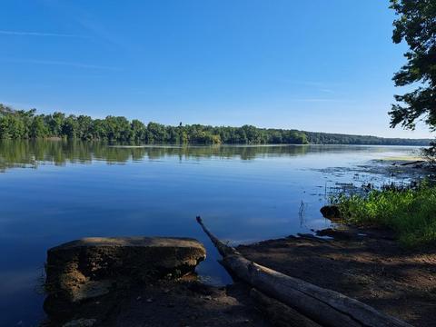
The Clear Fork River empties into the western end of the lake. This western end of the lake is shallow with most of the area under less than 10 feet of water. The middle section of the lake gradually slopes to a depth of 20 feet. At that point, the lake makes a sharp bend to the south, and the basin changes to a steep-sided, deep, gorge shape with a maximum depth of 35 feet.
The portion of the lake that runs from west to east is shallower and warmer. The bottom of that part of the lake is composed of mud (clay and silt), except along the shorelines where wave action has exposed sand and small gravel. The lower portion of the lake, running north to the south, is deeper, slightly cooler, and has larger boulders along the shoreline. Vegetation is confined to the shoreline of the western end of the impoundment and is controlled by water clarity. The transparency of the water varies from about 6 inches in the springtime to 4 feet later in the season, when the sediment has settled.
Features
Restrooms on site
Content from Ohio Ornithological Society
