Englewood MetroPark--North Park
Englewood MetroPark--North Park
Vandalia, Ohio 45377
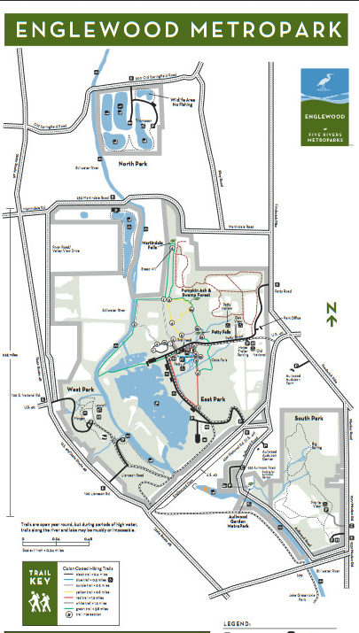
Englewood MetroPark Official WebsiteEnglewood MetroPark map
About Englewood MetroPark
See all hotspots at Englewood MetroPark
Englewood MetroPark is one of five natural areas created by the construction of earthen flood control dams. Stillwater River, lakes, woods, and wetlands serve as focal points of this 1,900-acre MetroPark.
Englewood MetroPark is a large and heavily utilized MetroPark. The natural areas of the park contain floodplain forests, large areas of former farmland in natural succession, second-growth upland hardwood forest, significant remnants of mature and old-growth forest, a large shallow lake/wetland, several managed grasslands, and the scenic Stillwater River. The park also contains a series of rehabilitated gravel quarries along Old Springfield Road (North Park).
Features
Restrooms on site
Wheelchair accessible trail
Entrance fee
Roadside viewing
Content from Englewood MetroPark Official Website
Last updated February 11, 2023