Knox Lake--Old Mansfield Rd. South
About Knox Lake
See all hotspots at Knox Lake
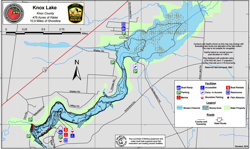
Knox Lake is located about 1.5 miles northeast of Fredericktown and can be accessed via OH-95. The marina and main boat ramp are located on the lower section of the reservoir along Armentrout Road. Other boat ramps are located off County Road 5 in the upper section of the reservoir.
Knox Lake was built by the Ohio Department of Natural Resources Division of Wildlife in 1954. The reservoir, created by damming the Kokosing River, was built primarily for recreation. The reservoir is 469 acres in size and has 11.4 miles of shoreline. The maximum depth is over 24 feet near the dam, although much of the water is 12 feet or less. The bottom composition is made up of rock and gravel in the lower section and mud and silt in the upper section. The upper section of the reservoir was purposely left full of standing timber to provide natural cover to enhance fishing. In the lower basin trees have been felled along the shoreline to provide additional cover.
Features
Restrooms on site
Wheelchair accessible trail
Entrance fee
Roadside viewing