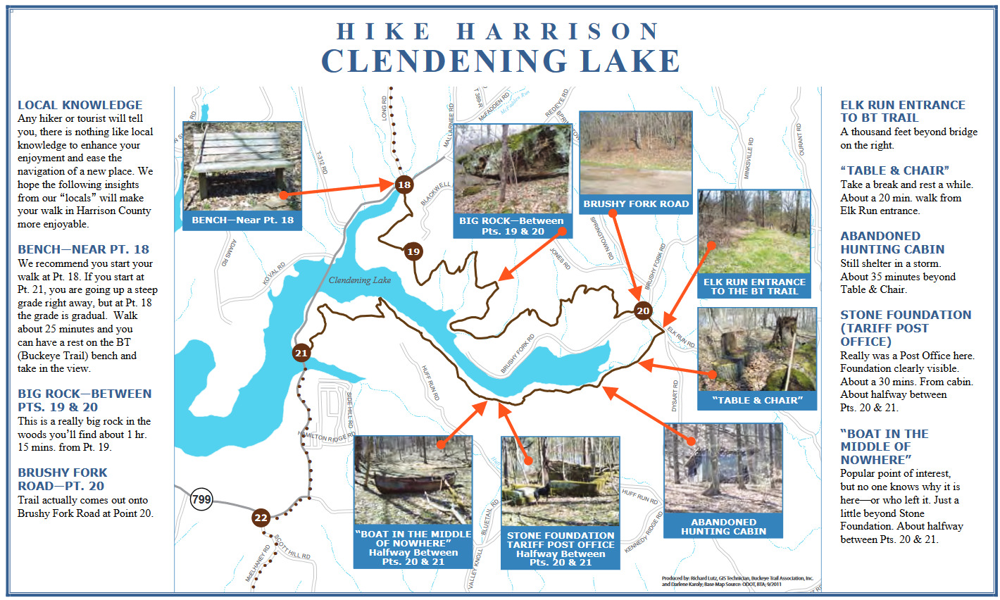
Clendening Lake--Buckeye Trail, North of Brushy Fork Bay
Clendening Lake--Buckeye Trail, North of Brushy Fork Bay
Freeport, Ohio 43973
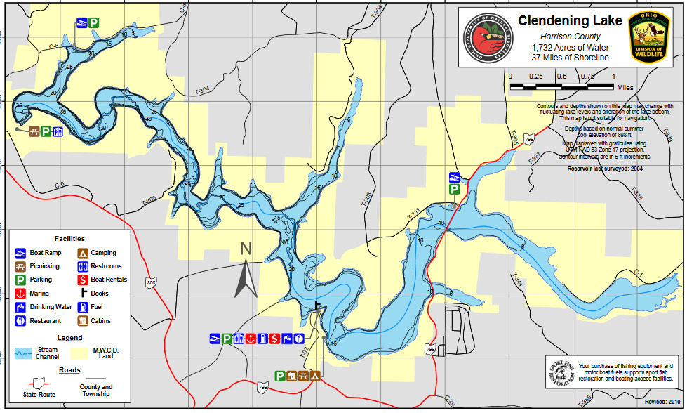
Clendening Lake mapClendening Lake (Muskingum Watershed Conservancy District) map
About Clendening Lake
See all hotspots at Clendening Lake
Clendening Lake is in southwestern Harrison County in Washington and Nottingham townships. The dam is at Tippecanoe off OH-800. OH-799 bisects the lake. Township roads provide access to the lake on all boundary lines. Access to I-77 is available at New Philadelphia which lies 25 miles to the north.
Clendening Lake, one of the flood control impoundments of the Muskingum Watershed Conservancy District, was constructed in Brushy Fork of Big Stillwater Creek. This 1,702-acre lake is mostly long, narrow, and winding and most of its 35.5 miles of shoreline are deeply wooded. There is a 10-horsepower outboard motor limit on this lake.
The Muskingum Watershed Conservancy District was organized under state law in 1933 for the primary purposes of flood control, conservation, and recreation. The first waters to form the permanent lakes were impounded in 1938. In 1939, the flood control aspect became the responsibility of the United States Army Corps of Engineers as part of the Ohio-Mississippi Flood Control Program.
Features
Restrooms on site
Content from Thanks to Scott Pendleton for describing these hikes. and Ohio Ornithological Society