Hog Creek Marsh
About this Location
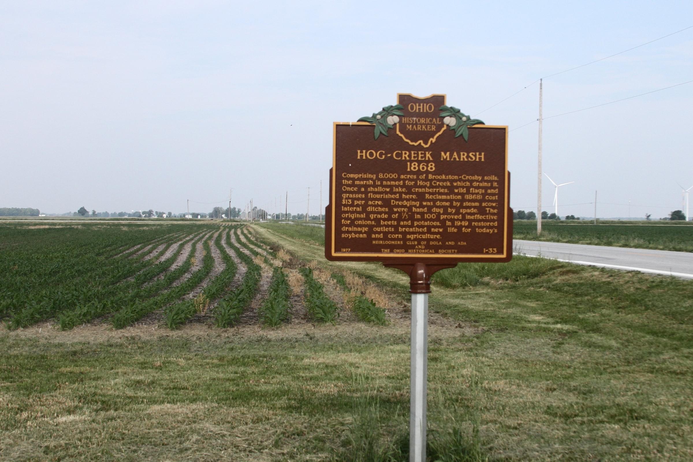
Comprising 8,000 acres of Brookston-Crosby soils, the marsh is named for Hog Creek which drains it. Once a shallow lake, cranberries, wild flags, and grasses flourished here. Reclamation (1868) cost $13.00 per acre. Dredging was done by steam scow; lateral ditches were hand dug by spade. The original grade of 1/3″ in 100′ proved ineffective for onion, beets, and potatoes. In 1949 restored drainage outlets breathed new life into today’s soybean and corn agriculture.
Features
Restrooms on site
Content from Hog Creek Marsh Historical Marker