Indian Mound Reserve
Indian Mound Reserve
2750 US-42 East Cedarville, Ohio 45314
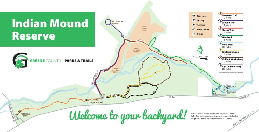
Indian Mound Reserve Official WebsiteIndian Mound Reserve map
About Indian Mound Reserve
See all hotspots at Indian Mound Reserve
One of the most popular Greene County parks, Indian Mound Reserve’s 169 acres offer one of the most diverse areas managed by Greene County Parks and Trails. The park is located just west of Cedarville, on US-42.
A spectacular natural resource is created with a blend of Cedar Cliff Falls, the Massie Creek Gorge, meadow, woods, river, and marsh, creating an amazing view in any season of the year. Native American history can be learned here with the Pollock Works, a Hopewell structure, and the Williamson Mound, an Adena structure, both of which are hundreds of years old. An 1800s cabin has been restored on the park grounds. Originally, the log cabin was constructed in Selma, Ohio as part of a young lady’s wedding dowry. It also played a role in the Underground Railroad and was probably an important part of the lives of slaves passing through Cedarville. The park also offers an extraordinary wildflower display in early May featuring about 125 species, some of which are rare, including snow trillium. It also boasts one of the largest groves of white arborvitae, a tree on Ohio’s protected species list.
Features
Restrooms on site
Wheelchair accessible trail
Entrance fee
Roadside viewing
Content from Indian Mound Reserve Official Website
Last updated February 13, 2023