Olentangy Trail
Olentangy Trail
Columbus, Ohio 43235
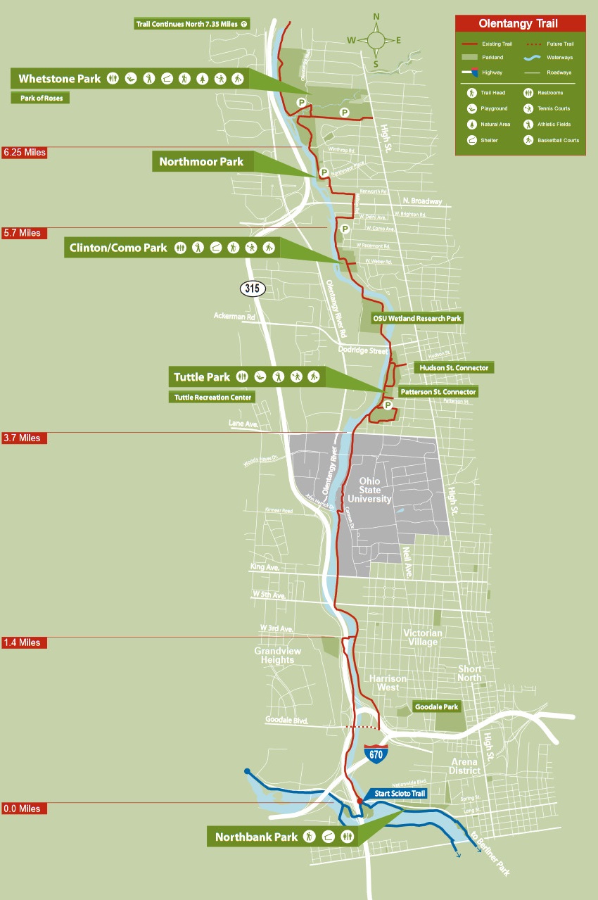
Official WebsiteOlentangy Greenway Trail Upper Section map
Olentangy Greenway Trail Lower Section map
About this Location
One of the most popular greenways in Ohio, this trail offers a seamless 13.75-mile route from Worthington Hills to downtown. The Olentangy Trail winds through several neighborhoods along the Olentangy River, with trailheads at several major city parks, including Antrim Park and Whetstone Park. The path also travels through the heart of the Ohio State University campus.
Notable Trails
Hikes of varying distances are possible from trailheads on the Olentangy Greenway Trail.
Content from Official Website
 Upper Section Map
 Lower Section Map