Chestnut Grove Cemetery, Olmsted Falls
Chestnut Grove Cemetery, Olmsted Falls
Lewis Road Olmsted Falls, Ohio 44138
Official WebsiteChestnut Grove Cemetery (Find A Grave) webpage
Birds of Interest
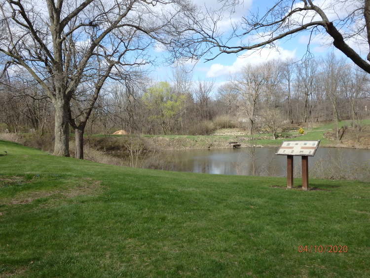
There is a pond in Chestnut Grove Cemetery that attracts ducks and geese.
About this Location
Chestnut Grove Cemetery in Olmsted Falls is also known as New Chestnut Grove Cemetery. The cemetery is located on the east side of Lewis Road south of the intersection with Water Street.
Olmsted Falls was part of territory granted by the U.S. government to Connecticut settlers who were displaced after the Revolutionary War in the late 1700s (now commonly known as the “Western Reserve”). Olmsted Falls was originally named Kingston Township around 1815. It then became Lenox Township, from 1822 until 1830, when it was renamed Olmsted Falls.
No restroom facilities. There are restrooms at East River Park across Lewis Road and at David Fortier River Park across the Rocky River from the cemetery.
Features
Roadside viewing
Restrooms on site
Wheelchair accessible trail
Entrance fee
Content from Penny O’Connor and Chestnut Grove Cemeteries webpage