Caesar Creek State Park


Caesar Creek State Park
8570 East OH-73 Waynesville, Ohio 45068
Caesar Creek State Park websiteCaesar Creek State Park map
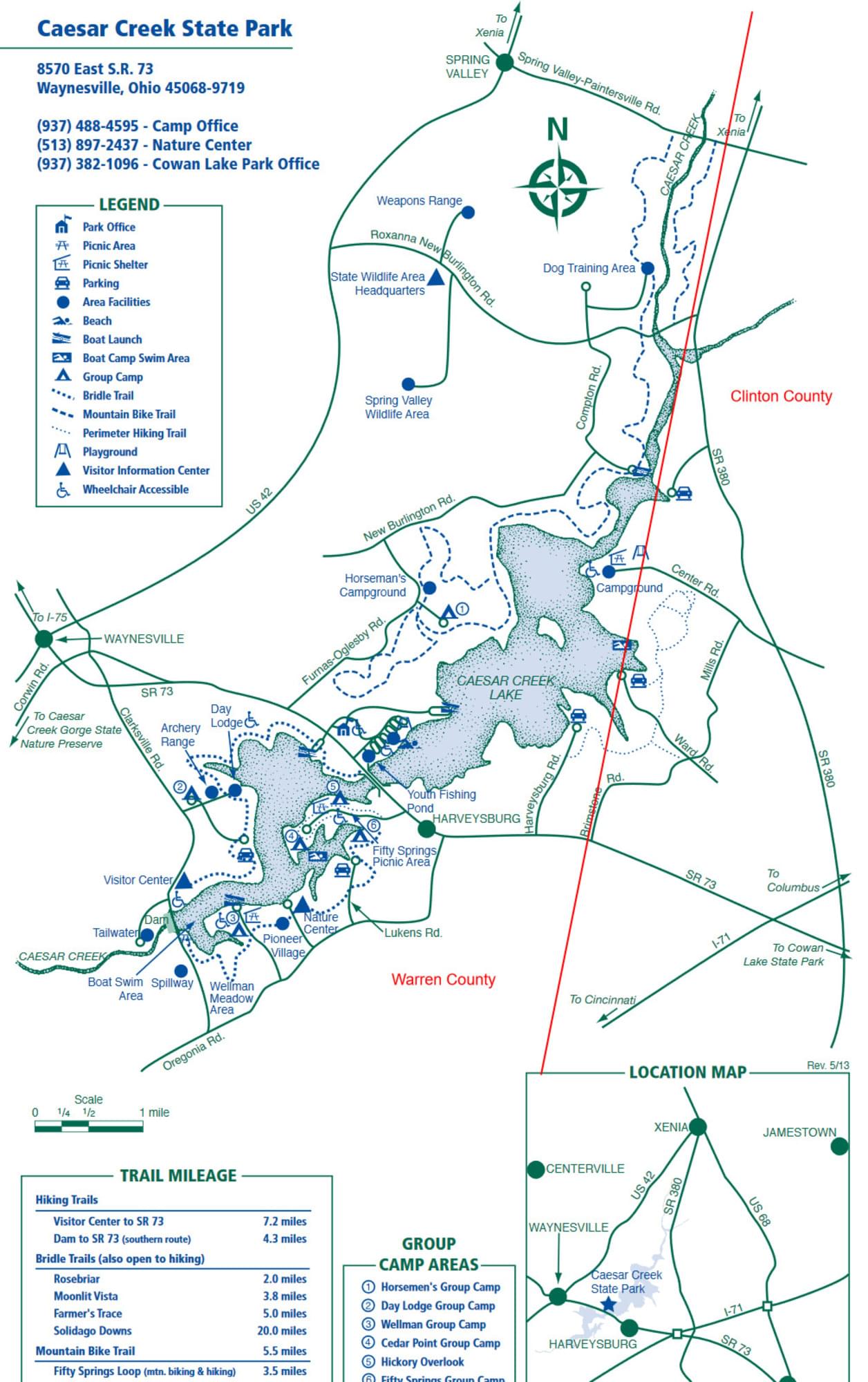
Caesar Creek Lake map
Tips for Birding
It is most helpful when submitting eBird observations at Caesar Creek State Park to start a new checklist for each hotspot within the reservation. If you carefully keep your bird records by county, be sure to use the specific hotspots in this park so that the birds will be assigned to the proper county.
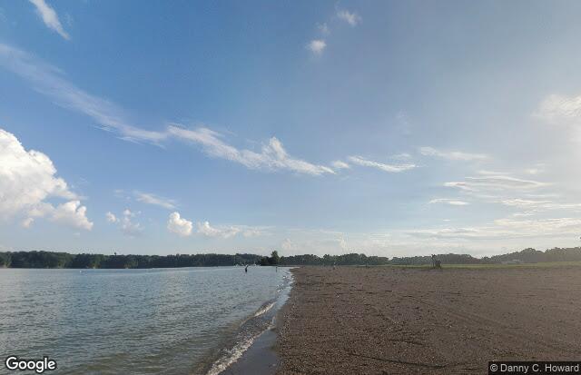
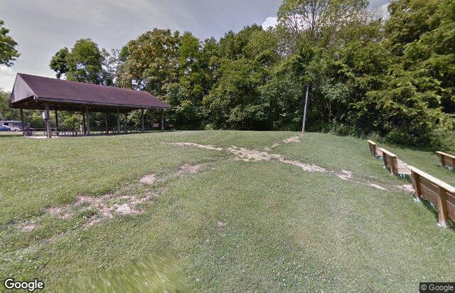
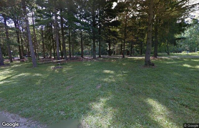
The park consists of 3,741 land acres and 2,830 water acres; another 2,959 wildlife acres are nearby. These areas feature woodlands, meadows, a prairie grass area, and two swimming beaches. There are 43 miles of hiking trails and 2 mountain bike trails.
The public beach can be good for gulls and shorebirds, especially early in the morning. Merganser Bay at the end of Harveysburg Road is especially good for waterfowl. There are many other good birding areas, including the campground, Luken’s Road, and Caesar Creek Gorge. During winter months the feeders at the Visitors Center can be good for Purple Finches and Pine Siskins. Rare species observed in the park include Laughing Gull, Lesser Black-backed Gull, California Gull, Red-throated Loon, Pacific Loon, Red-necked and Western Grebes, American Avocet, Marbled Godwit, Willet, Baird’s Sandpiper, Piping Plover, Sanderling, Surf Scoter, White-winged Scoter, Long-tailed Duck, and American White Pelican.
From Waynesville, go east on OH-73 to Clarksville Road, turn right to Visitor’s Center, or continue on OH-73 to the main park entrance on left.
The park is open during daylight hours only.
There is plenty of parking throughout the park.
There is a list of birds seen recently at the Visitors Center where a checklist of the Birds of Caesar Creek is also available.
Birds of Interest
Winter
American Black Duck, Lesser Scaup, Redhead, Common Loon, Bald Eagle, Northern Harrier, Northern Mockingbird, Red-shouldered Hawk, Fox Sparrow, Ring-billed Gulls
Spring
Pied-billed Grebe, Horned Grebe, Spotted Sandpiper, spring waterfowl and songbird migrants.
Summer
Lesser Yellowlegs, Least Sandpiper, Semipalmated Sandpiper, Solitary Sandpiper, Pectoral Sandpiper, Northern Shoveler, American Wigeon, Green-winged Teal, Caspian Tern, Forster’s Tern, Common Tern, Sedge Wren, Summer Tanager, Scarlet Tanager.
Fall
Red-breasted Merganser, Osprey, Dunlin, Franklin’s Gull, Bonaparte’s Gull, Double-crested Cormorant, and American Coot.
About this Location
The Caesar Creek State Park area sits astride the crest of the Cincinnati Arch, a convex tilting of bedrock layers caused by an ancient upheaval. Younger rocks lie both east and west of this crest where some of the oldest rocks in Ohio are exposed. The sedimentary limestones and shales tell of a sea hundreds of millions of years in our past that once covered the state. The park’s excellent fossil finds give testimony to the life of this long-vanished body of water.
The forests of the area are comprised of over 65 species of plants. Several major communities thrive in the area. A northern floodplain forest is found in the valley, while mixed associations of oak-hickory and beech-maple woodlands clothe the ridges and hillsides. Red-tail hawks, white-tail deer, raccoons, red foxes, and box turtles make the park their home.
There are numerous restrooms in Caesar Creek State Park, but most are closed during the cold months. The Visitor’s Center has flush toilets available when the Center is open.
Notable Trails
Caesar Creek State Park Trails
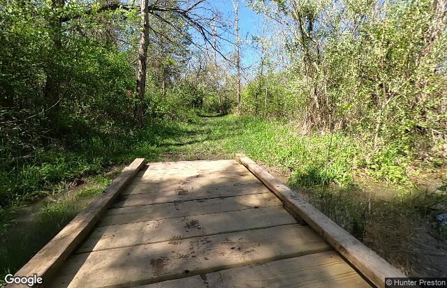
There are multiple trails at Caesar Creek that are specifically designated for hiking. These trails are rated moderate to difficult. They include scenic waterfalls, a swinging bridge and views of the lake.
Park Hiking Trails
Fifty Springs Loop Trail – 3.3 miles – Moderate-Difficult
Connector Trail between Fifty Springs and Perimeter Trails – .1 mile – Moderate-Difficult
Horseshoe Falls Trail – 0.7 miles – Moderate-Difficult
Old Woods Trail – 0.6 miles – Moderate-Difficult
Peninsula Trail – 1 mile – Moderate-Difficult
Perimeter Trail – 12.7 miles – Moderate-Difficult
The Cove Trail – 0.7 miles – Moderate-Difficult
White Trail – 0.1 mile – (Connector)
Horseshoe Falls Trail – 0.7 miles – Moderate-Difficult
Buckeye Trail – Several miles pass through the west side of the park – Moderate-Difficult
Campground Trails
Deer Run Trail – 1.4 miles – Moderate
Lakeview Trail – 0.7 miles – Moderate
Pin Oak Trail – 1.2 miles – Moderate
The Point Trail – 1.1 miles – Moderate
Four bridle trails also allow hiking:
Rosebriar Trail – 2 miles – Easy
Moonlit Vista Trail – 3.7 miles – Easy
Farmer’s Trace Trail – 4 miles – Easy
Silidago Downs Trail – 28 miles – Easy
Two mountain bike trails also allow hiking:
Fifty Springs Loop – 3.5 miles – Easy – The Fifty Springs loop is an easy oval loop around the Fifty Springs peninsula, which is a two-mile road ride from the Harveysburg Road trailhead. The trail includes one intermediate-level ravine crossing.
Mountain Bike Trail – 16 miles – Difficult – The Harveysburg trail system spans the gap between Harveysburg Road and the campground, with 16 miles of the trail made up of four principal loops plus connecting mileage. The first 2 miles of the main trail are suited for intermediate and advanced riders; steep climbs and drops on the remainder challenge advanced cyclists.
Portions of the Buckeye Trail go through the park.
Descriptions with maps of hikes in Caesar Creek State Park are on the AllTrails website.
Content from Caesar Creek State Park website and Ohio Ornithological Society
Last updated January 21, 2024