Four Mile Creek MetroPark--Mill Race Preserve Area
Four Mile Creek MetroPark--Mill Race Preserve Area
5401 Corso Road Oxford, Ohio 45056
Official WebsiteMill Race Preserve Area map
Four Mile Creek MetroPark Official Website
Tips for Birding
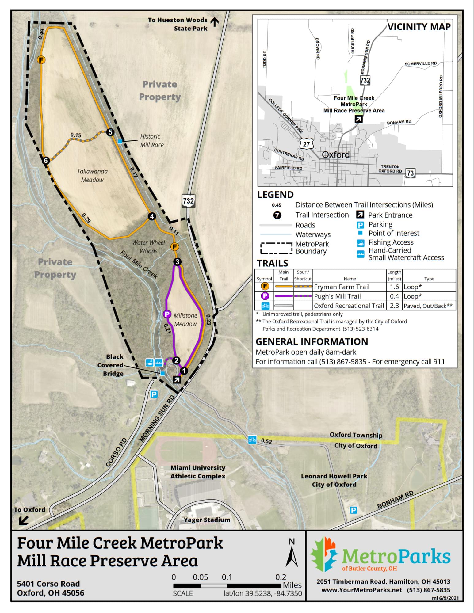
The southern Pink/Pugh’s Mill Trail is encountered first and circles around the Millstone Meadow which attracts nesting Carolina Wrens, Common Yellowthroats and Field and Song Sparrows.
There is a connector to the northern Orange/Fryman Farm Trail which goes around the Tallawanda Meadow (mostly grassland) with two short-cuts. Both trails/meadows are surrounded by forested areas.
Most of the trail system is open, with a short connector through the forest. Four Mile Creek runs to the west, but the trails do not run past or cross the creek, therefore there is no creek access at this time.
About this Location
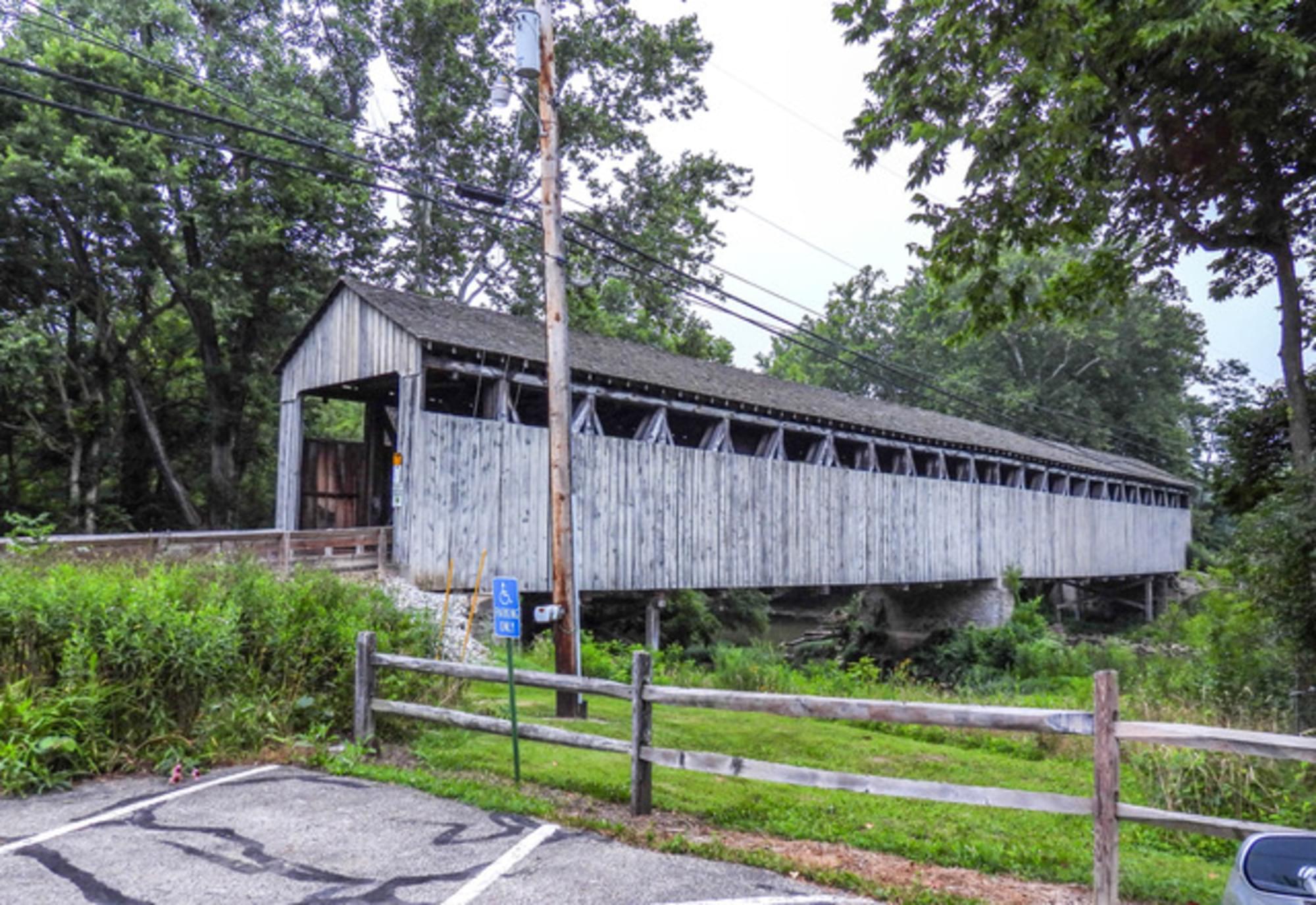
One of the few remaining covered bridges in southwestern Ohio and the only one in Butler County on its original site, the Black (Pugh’s Mill) Covered Bridge was built in 1868 to give access to a saw and grist mill owned by James B. Pugh on Four Mile (Talawanda) Creek. Pugh’s Mill ceased to operate after two decades, and the name of the span gradually changed to Black Bridge, likely because there was a white covered bridge located downstream. The Black Covered Bridge is recognized as one of the longest and most impressive of Ohio’s covered bridges. It is unique for its combination of two truss types, Childs and Long, within a single structure. The bridge was restored in 2000 through the efforts of the Oxford Museum Association, the Butler County Commissioners, and the Butler County Engineer’s Office. A State of Ohio Bicentennial Historical Marker has been placed at the site.
The parking area at the Black Covered Bridge is a trailhead for Mill Race Preserve itself as well as for the Oxford Area Trail System. The Black Covered Bridge Connector Trail is paved for 1 mile. The next 1.5 mile to OH-73 is coal cinders, scheduled to be paved by 2022, then there is another 1.5 mile paved connecting to Peffer Park at US-27.
There are no restrooms at this trailhead, but portable toilets may be found at the Bonham Road trailhead 1 mile southeast and the OH-73 crossing 2.5 miles southeast.
The Black Covered Bridge Connector Trail is handicap accessible, but the majority of the Mill Race Preserve trails are not.
About Four Mile Creek MetroPark
See all hotspots at Four Mile Creek MetroPark
Four Mile Creek wanders across Butler County and joins Seven Mile Creek to empty into the Great Miami River just north of Hamilton. There are 3 sections of this park open:
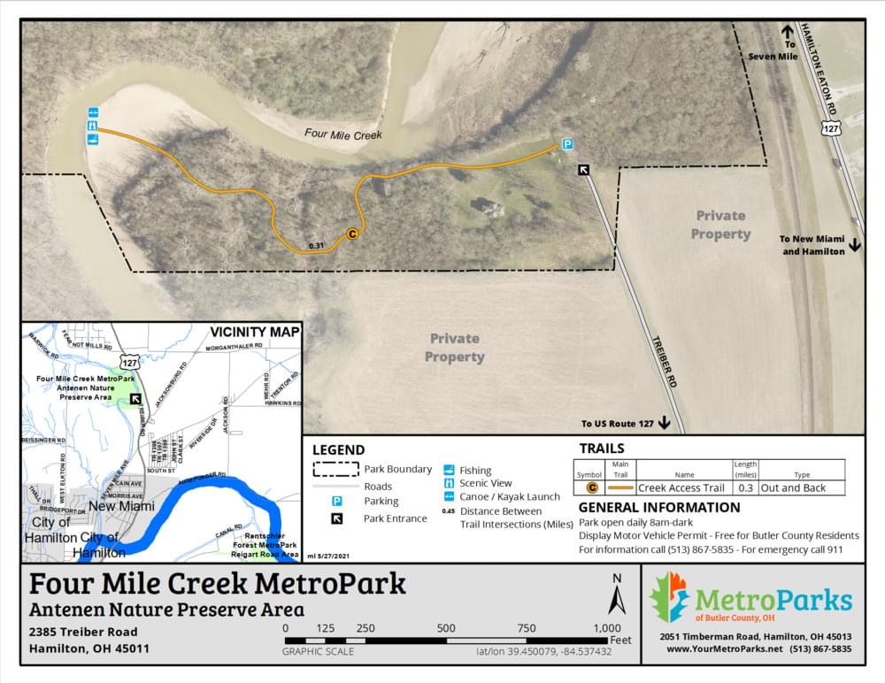
Antenen Nature Preserve
Mill Race Preserve
Sycamore Bluffs
From Four Mile Creek MetroPark webpage
Features
Wheelchair accessible trail
Entrance fee
Restrooms on site
Roadside viewing
Content from Sue Parks and Black Covered Bridge webpage
Last updated February 8, 2023